Examples Example 1 of 4
Example 1 · Ballston, Arlington County, Virginia
Commercial redevelopment on urban fill
The job. A 3.09 acre office pad near Ballston in Arlington County, Virginia, is being redeveloped. The existing site is almost all roof and pavement. The owner wants a little more landscaping and an underground detention vault under the new parking deck. The 10-year, 24-hour storm governs.
About this example
This is a real run on app.curvenumber.com, made under the CurveNumber Examples account. The place is real. The client, the plans and the geotechnical report are fictional, and the run says so wherever they are named.
What this example shows
- A site where the soil survey gives no soil group at all, and what CurveNumber does about it.
- A “no headline yet” run that is saved and never charged.
- Answering the soil question from a geotechnical report, with a written reason.
- Editing the proposed areas, and a curve number read straight out of TR-55.
- Overriding a curve number, and how the report flags a large change.
- Routing the proposed runoff through an underground vault with an orifice.
- Publishing a fixed link for the plan reviewer.
01Create the project and the site
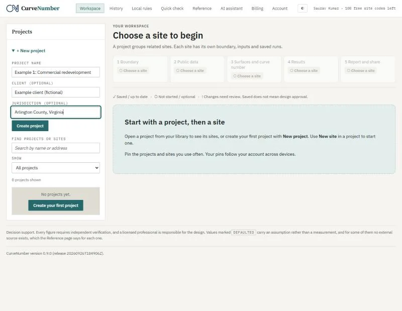
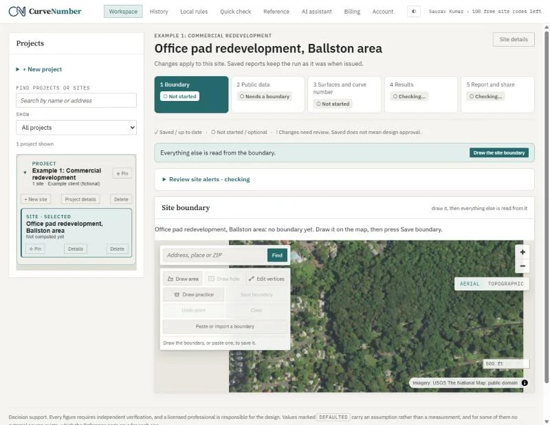
On the Workspace, open + New project, name it, and add the client and jurisdiction. Then press + New site inside the project.
02Draw or paste the boundary
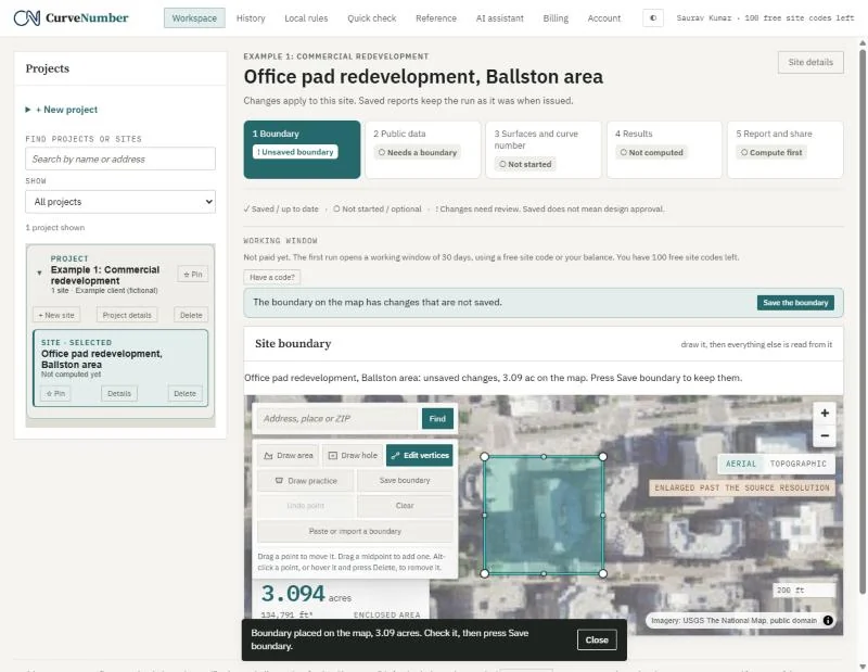
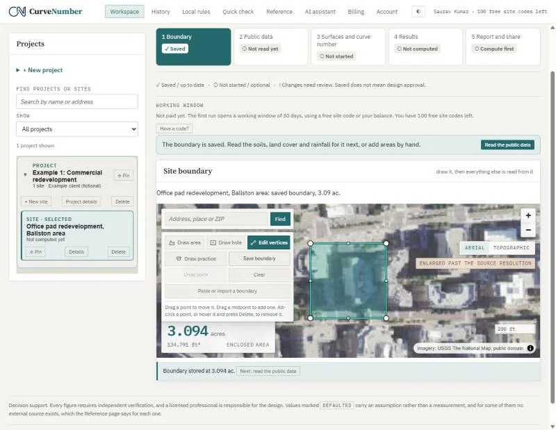
Draw the area on the aerial photograph, or use Paste or import a boundary to paste GeoJSON, WKT or KML, or to load a .geojson, .kml or .wkt file. CurveNumber shows the enclosed area (here 3.094 acres). Press Save boundary to keep it.
03Read the public data
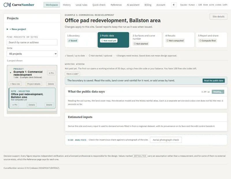
Press Read the public data. CurveNumber asks four public services at once: the USDA soil survey (SSURGO), the national land cover map (NLCD), the USGS elevation model (3DEP), and NOAA Atlas 14 rainfall. A slow service does not hold up the others.
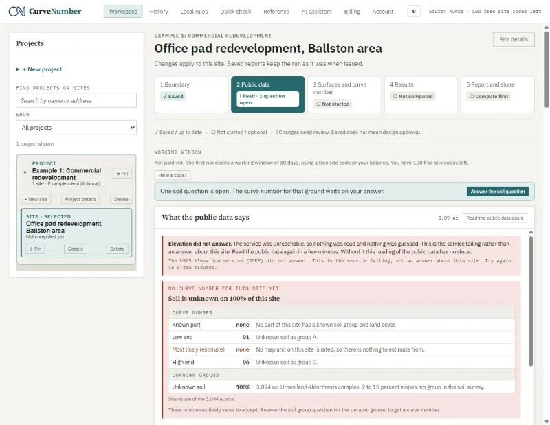
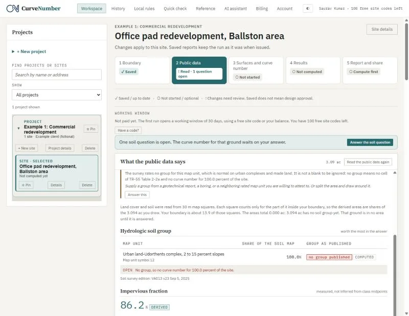
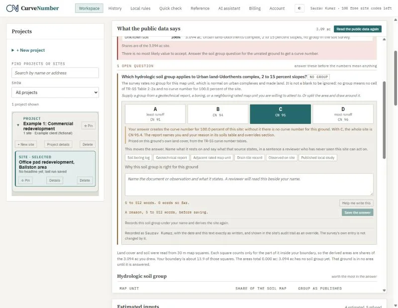
Here the soil survey maps the whole site as Urban land-Udorthents complex, a map unit with no hydrologic soil group. That is normal for old urban fill, but it means TR-55 has no curve number for 100 percent of the site. CurveNumber does not guess. It shows the range instead: CN 91 if the ground behaves like group A, up to CN 96 if it behaves like group D, and asks you one question.
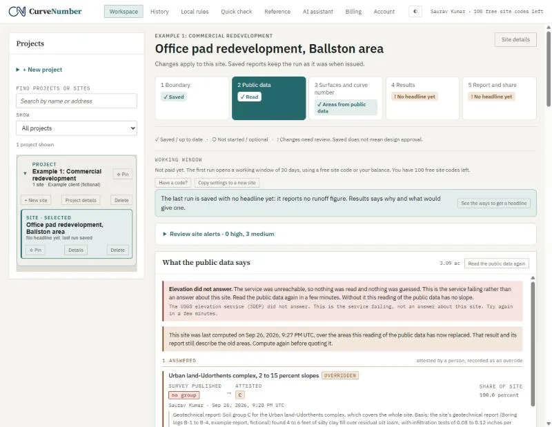
It also says plainly when a service fails. On the day of this example the USGS elevation service did not answer, so the page says so and reads no slope, rather than inventing one. We entered the time of concentration by hand instead.
The rainfall table gives the NOAA Atlas 14 24-hour depths at the site, from 1-year to 100-year. We used the 10-year depth, 4.85 inches.
04A run with “no headline yet”
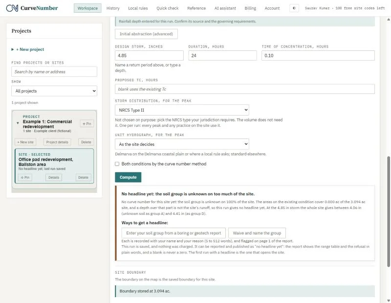
You can compute before answering the soil question. CurveNumber saves the run, does not charge for it, and leads with the ways to get a headline number:
- Enter your soil group from a boring or geotechnical report.
- Waive and name the group yourself.
It also shows what the answer would be either way: between 4.06 and 4.41 inches of runoff at 4.85 inches of rain. A blank is never shown as a zero.
05Answer the soil question from the geotechnical report
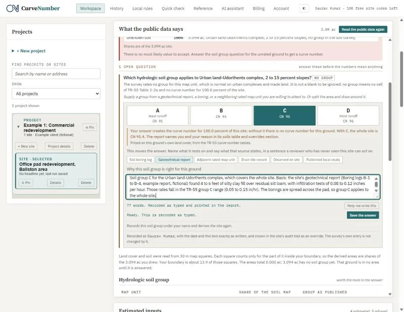
Pick the group (we chose C), say where it comes from (Geotechnical report), and write the reason. Every reason box takes 5 to 512 words and shows the count as you type.
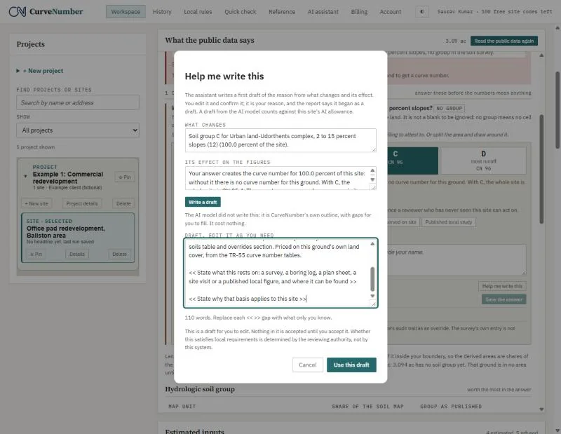
Help me write this opens a first draft from the change and its effect. You edit it and confirm it; nothing is accepted until you do, and the report says when a reason began as a draft.
Our reason: the fictional geotechnical report found silty clay fill with infiltration rates of 0.08 to 0.12 inches per hour, which is within the TR-55 group C range of 0.05 to 0.15 inches per hour.
06Existing and proposed areas
With the soil group known, CurveNumber builds the existing condition from the measured land cover: 2.666 acres of pavement and roof (CN 98) and 0.428 acres of open space in fair condition on group C (CN 79).
Copy the existing areas into the proposed condition, then edit what changes:
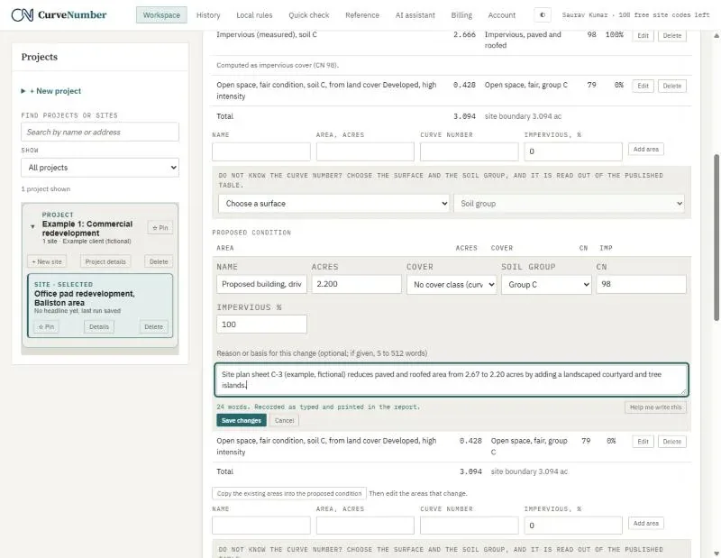
- The paved and roofed area drops to 2.200 acres, with a reason citing the site plan.
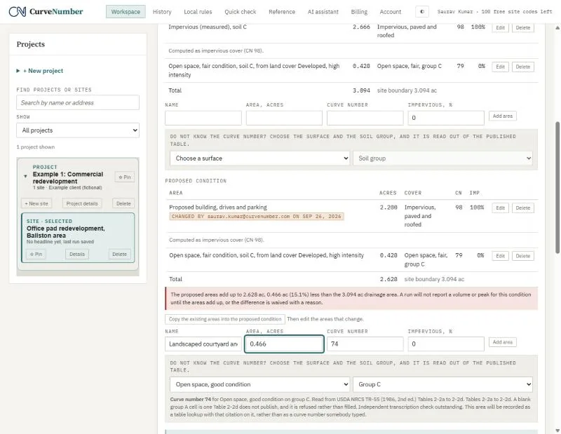
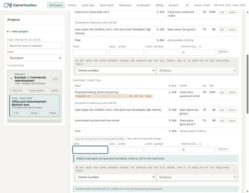
- A new 0.466 acre landscaped courtyard is added by choosing the surface (Open space, good condition) and the soil group (C). CurveNumber reads CN 74 straight out of TR-55 Table 2-2a and cites it.
If the areas do not add up to the site, CurveNumber says so in red and will not report a volume or peak until they do.
07Override a curve number, with a reason
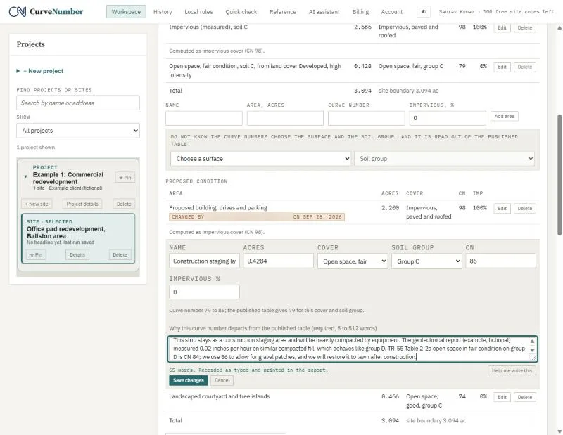
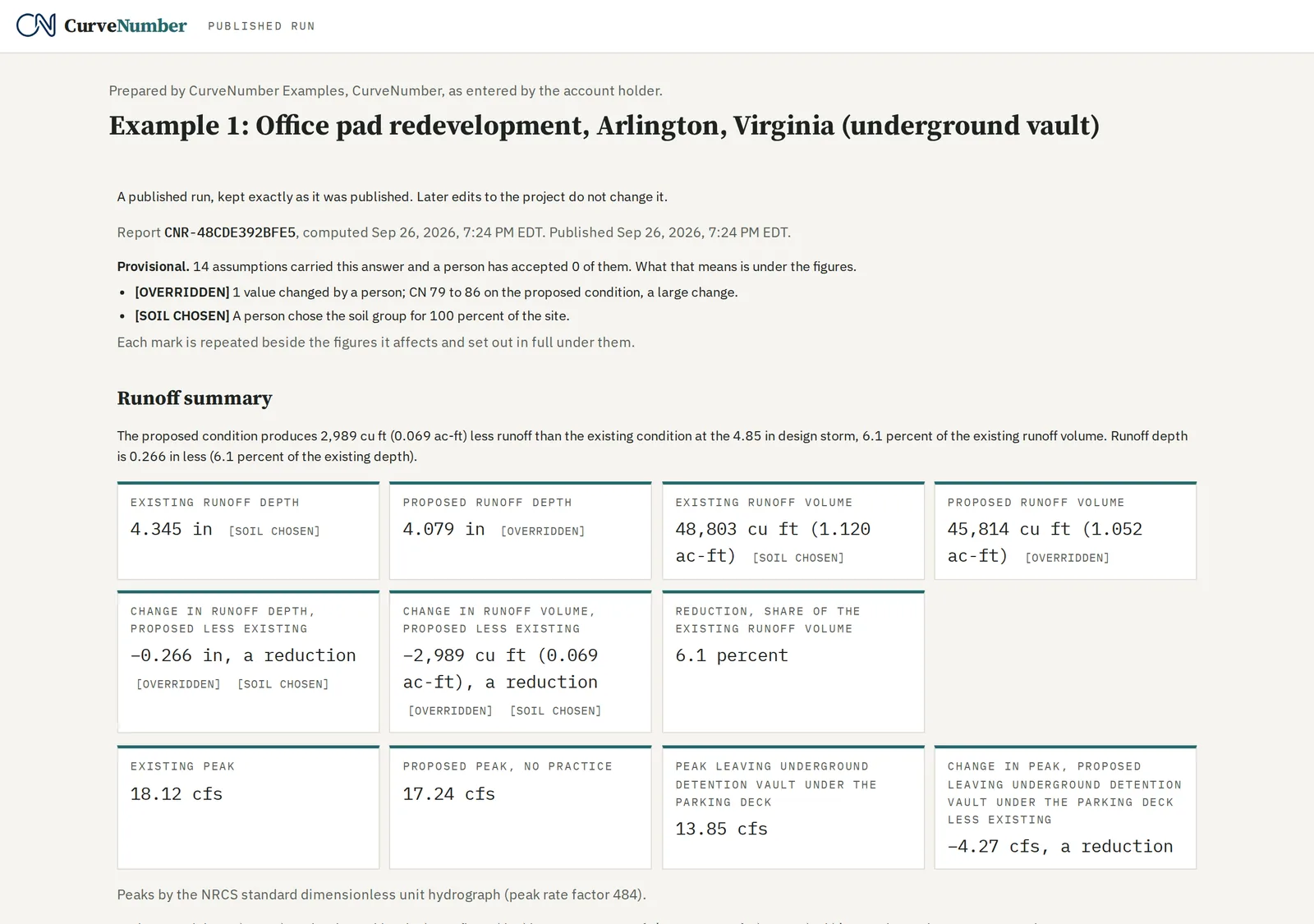
The strip that stays as a construction staging area will be heavily compacted. We changed its curve number from 79 to 86 and said why: compacted fill behaves like group D, and TR-55 gives CN 84 for fair open space on group D. We used 86 to allow for gravel patches.
A change of 5 curve number points or more is marked large on the report, next to every figure it affects.
08Compute
Choose the storm distribution your jurisdiction requires (here NRCS Type II) and press Compute. The first run with a headline uses one free site code and opens a 30-day working window.
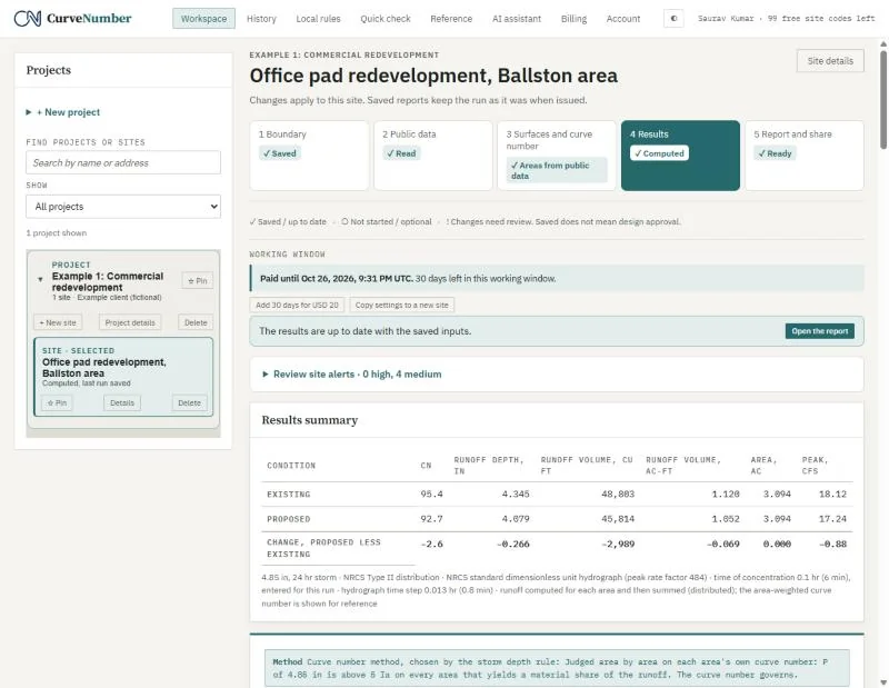
| Curve number | Runoff depth | Runoff volume | Peak | |
|---|---|---|---|---|
| Existing | 95.4 | 4.345 in | 48,803 cu ft | 18.12 cfs |
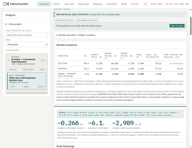
| Proposed | 92.7 | 4.079 in | 45,814 cu ft | 17.24 cfs |
CurveNumber computes runoff area by area on each area's own curve number and adds them up, rather than averaging the curve numbers first. We checked the depths by hand with the TR-55 runoff equation; they match to the last digit.
09Add the underground vault
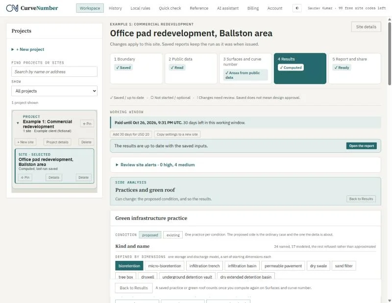
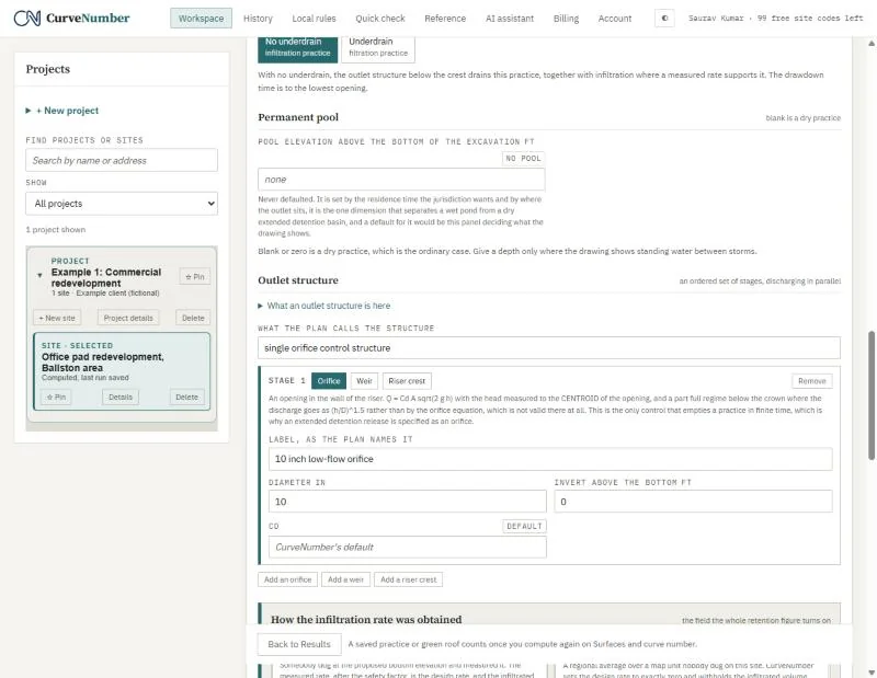
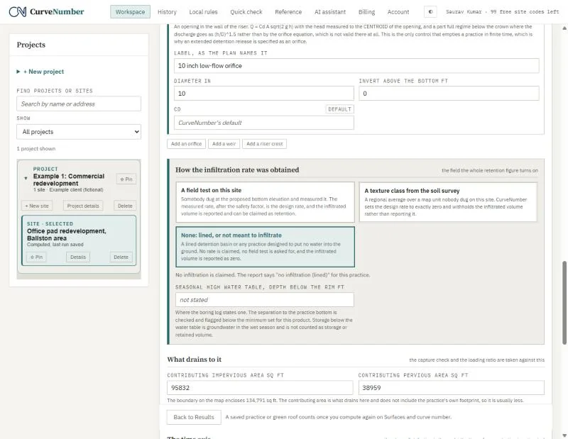
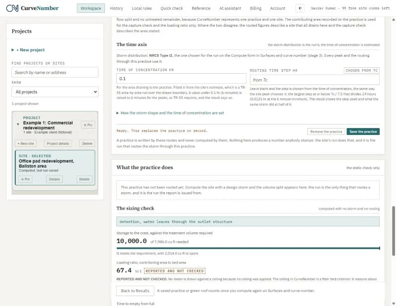
Open Practices and green roof from Results. Choose the kind (underground detention vault), give the footprint (2,000 square feet), and add the outlet: a single 10-inch orifice at the bottom. Mark the vault as lined, so no infiltration is claimed.
The sizing check shows 10,000 cubic feet of storage against the treatment volume needed.
Adding a practice changes the site, so CurveNumber asks you to acknowledge that the last run no longer describes it, and to give a reason. Then compute again.
10Results with the vault
The proposed peak leaving the vault is 13.85 cfs, down from 18.12 cfs existing and 17.24 cfs with no practice. CurveNumber also reports that in this storm the vault overflowed: 2,342 cubic feet, 5.1 percent of what reached it, went over the crest untreated. It says so on Results and on page 1 of the report, so the reviewer sees it too.
11The report and the published link
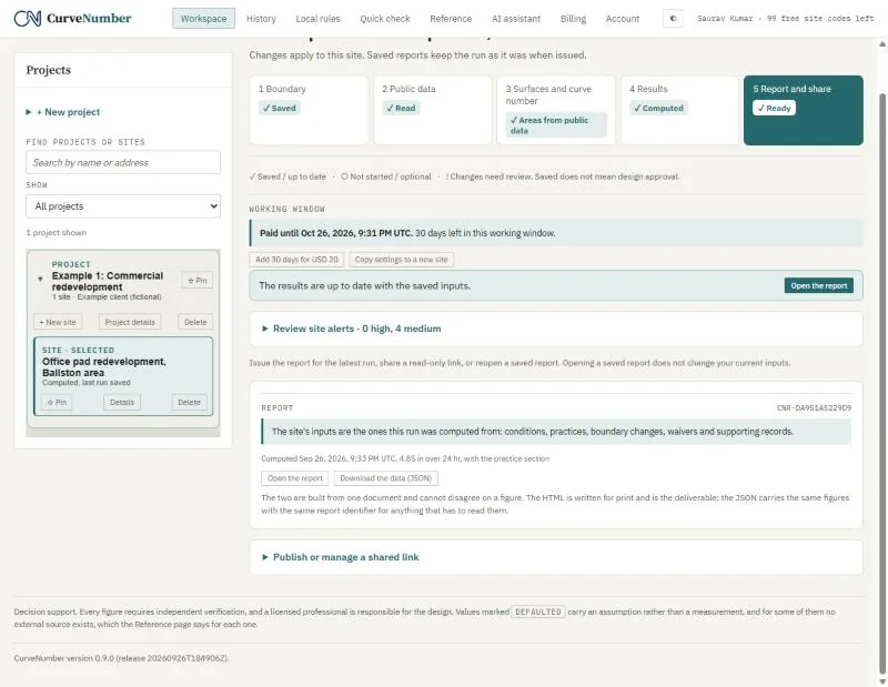
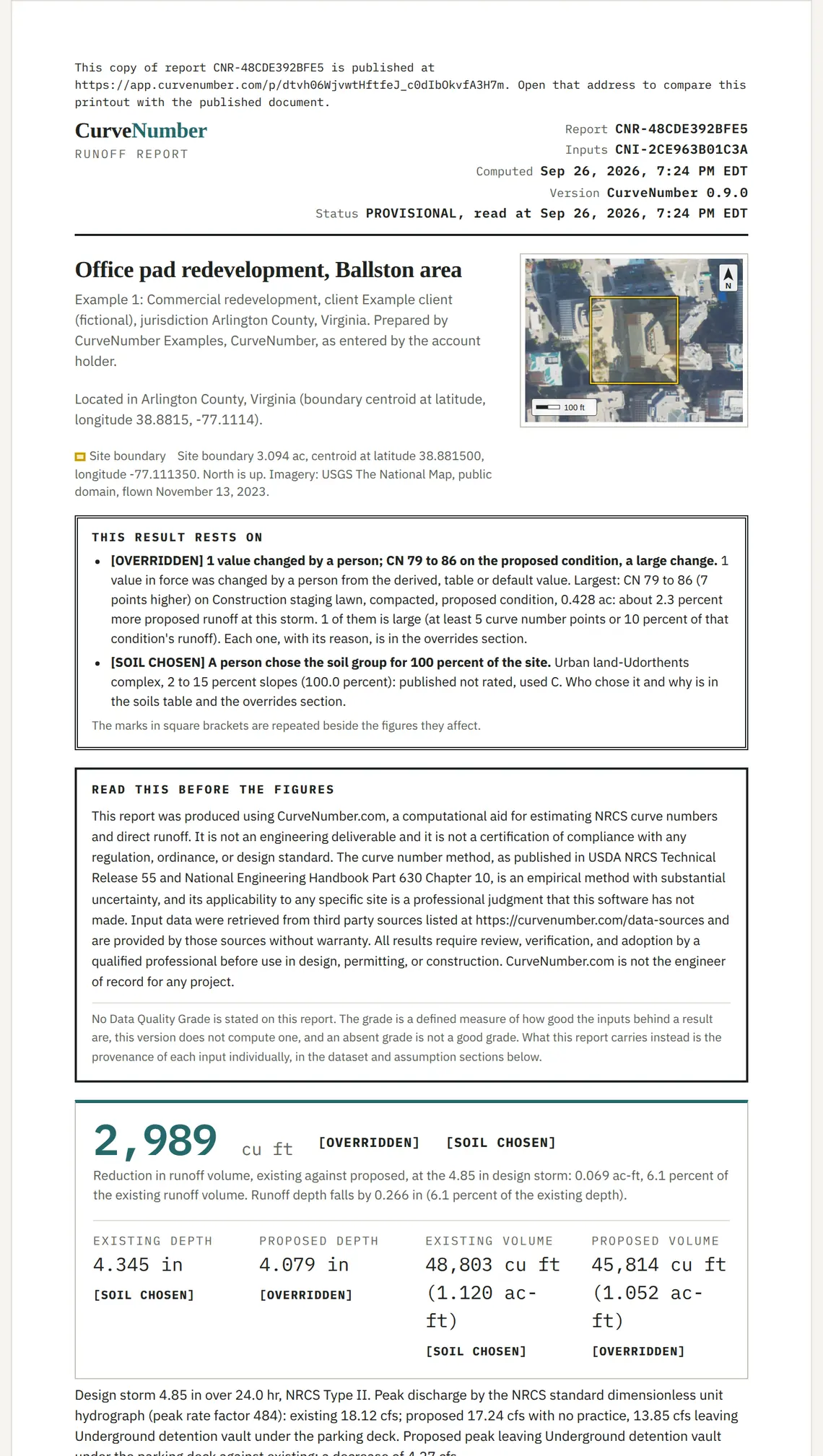
Open the report gives the printable report. It starts with a short reviewer summary:
- page 1: the headline figures and what they rest on;
- page 2: what was entered;
- page 3: every change a person made, with its reason.
The full record follows. Print it with your browser's Print, then Save as PDF.
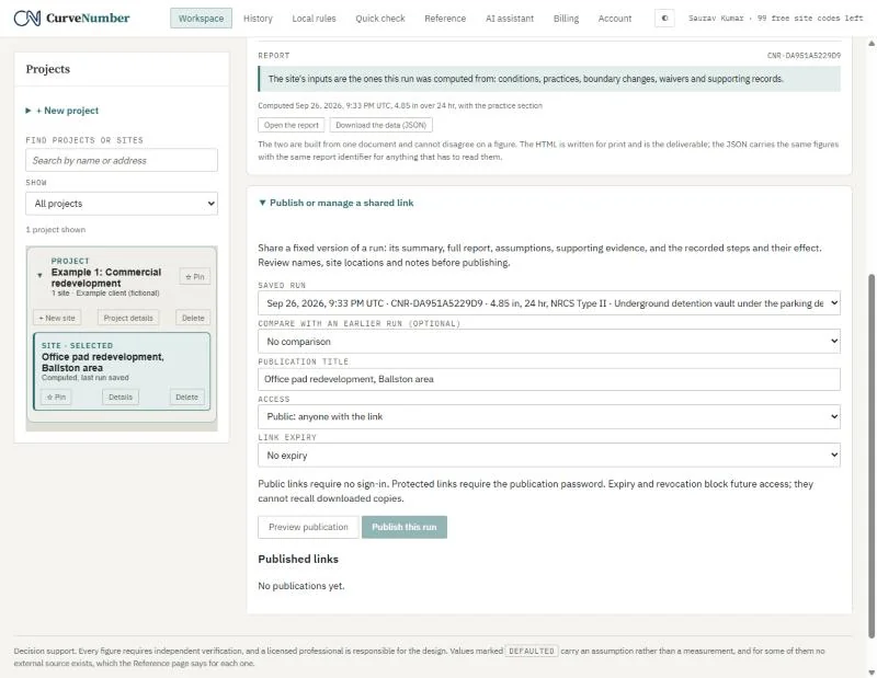
Publish a run makes a fixed, read-only link for the reviewer. A published link never changes: if you publish again, you get a new link, and the old page says a newer version exists. Every printed page carries the report id and the published address.
The published example
A fixed, read-only page with the full report, exactly as it was published. It needs no account.
https://app.curvenumber.com/p/dtvh06WjvwtHftfeJ_c0dIbOkvfA3H7m